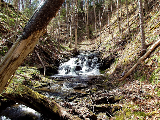
Glengarry, Inverness County
46° N 02.181 061° W 28.484
UTM: 20T E 618027 N 5099217
RIVER: Campbell Brook
WATERSHED: Southwest Mabou River
CLASS: steep cascades
SIZE: 10', 10', 12'
RATING: average (***)
TRAIL: bushwhacking
DISTANCE: 600m
HIKING TIME: 30 minutes
CONDITIONS: moderate, off-trail
GEOCACHE: none
NS Atlas Page: 12/V5
NS topo map: 011K03 (Lake Ainslie)
DRIVING DIRECTIONS: from Port Hastings, at the Canso Causeway, follow the roundbout onto HWY19 (the Ceilidh Trail). Follow this road northwest for 49km and turn left onto Hunters Road, a few kilometers past the village of Port Hood. Continue up this dirt road for 2.6km, where there is a nice pull-out spot on the left side of the road (the upstream side of the road). Park here. Google Maps estimates this to be a 46 minute trip.
TRAIL DESCRIPTION: hike back down Hunters Road about 100m and hike upstream along the main branch of Campbell Brook. The hike will require simply hopping back and forth across the brook where the easiest path presents itself.
There are three distinct falls along this brook, each of between 10 to 12 feet in height, overall. The lower set (pictured second) are set in an open valley with a nice series of low cascades extending for some distance below. They are located about 300m up the brook. The middle set of falls (pictured above) are about the same height as the first set, dropping oround a right hand turn in the brook. The upper falls (pictured at the top of this article) are also the highest, but still below 15feet total drop in its setting.
These are a pretty set of falls, and are found on the lands originally granted to John Larraby, one of the earliest Loyalist pioneers in Cape Breton, arriving in 1788 and settling on his original grant, which he called Hill Row, an 84-acre parcel along with Larraby's Island, at the mouth of the Southwest Mabou River (This island is known called Nicholsons Island). By 1824, he sold the land to Archibald McDonald as he was already in residence on his lands here, which he had been granted in 1809.
Mr. Larraby, a cooper by trade, had his homestead downstream from the road, which traces can still be seen today by the depressions in the ground near where both branches of Campbell Brook meet. He was born 1764 in Carroll County, New Hampshire and was married to Elizabeth Hawley. He arrived in Cape Breton with his whole family, including 6 sons and 4 daughters.
The brook is named for John Campbell ("Iain Chambiel"), who held the land surrounding the headwaters of Campbell Brook on Rocky Ridge Road.


No comments:
Post a Comment