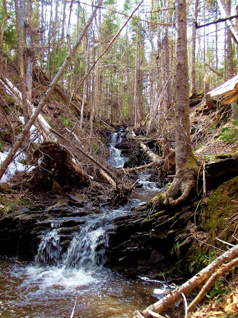
NORTH BRANCH CAMPBELL BROOK FALLS
Glengarry, Inverness County
46° N 02.565 061° W 27.992
UTM: 20T E 618648 N 5099940
RIVER: Campbell Brook (North Branch)
WATERSHED: Southwest Mabou River
CLASS: steep cascades
SIZE: 10'
RATING: average (***)
TRAIL: bushwhacking
DISTANCE: 550m
HIKING TIME: 30 minutes
CONDITIONS: moderate, off-trail
GEOCACHE: none
NS Atlas Page: 12/V5
NS topo map: 011K03 (Lake Ainslie)
DRIVING DIRECTIONS: from Port Hastings, at the Canso Causeway, follow the roundbout onto HWY19 (the Ceilidh Trail). Follow this road northwest for 49km and turn left onto Hunters Road, a few kilometers past the village of Port Hood. Continue up this dirt road for 2.6km, where there is a nice pull-out spot on the left side of the road (the upstream side of the road). Park here. Google Maps estimates this to be a 46 minute trip.
TRAIL DESCRIPTION: an old trail, recognized on my GPS topo map as an 'abandoned railline' makes a more or less undergrowth and snaggle free hike for more or less the entire hike to these falls. There are several spots along the low-lying portion of this brook that you have to jump over the stream, but it isn't a very wide watercourse. The LONG abandoned rail line eventually follows the second tributary of the North Branch of Campbell Brook, the main brook continues straight along the valley bottom. Along this tributary, at the head of the small valley, is where you will find these small, but charming, falls.
The valley is quite wide and shallow above the falls, with barrens surrounding the upper slopes, with an open and airy overstory, light penetrates these south-facing falls. Found on the lands of grantee John Hammond, a Loyalist settler for whom nearby Hammond Brook Falls is named.


No comments:
Post a Comment